
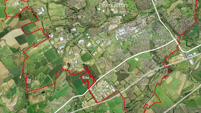
The site occupies an edge of settlement location, and is located within the Livingston Countryside Belt, primarily intended to prevent coalescence between settlements. It comprises open agricultural fields bounded by a mix of tree belts and woodland. Despite its open character, the combination of tree lined boundaries, woodland and the detailed topographic pattern of the site considerably restrict the visibility of much of the site from the surrounding area.
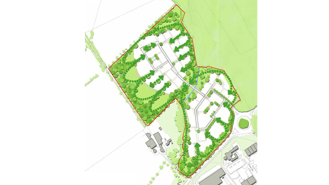
A landscape led masterplan was developed, which reinforced and extended the existing landscape structure of the site and introduced open space setbacks to boundaries to minimise visibility of development from the surrounding area. This approach ensured that the scale and extent of development did not exceed the landscape capacity of the site, by nestling the development into the site where it had little impact on its wider setting and minimised the effect of settlement coalescence.
The original planning application was refused, but subsequently approved at appeal. h+m provided further detailed written submissions in relation to the landscape analysis and landscape and visual assessment work, particularly in relation to how with the landscape treatment proposed, the development could be successfully accommodated without compromising the overall landscape character of the Countryside Belt, and that the introduction of the proposed development would not result in the physical and visual coalescence of Livingston with Polbeth, and that consequently, the objectives of the Countryside Belt designation would be retained.